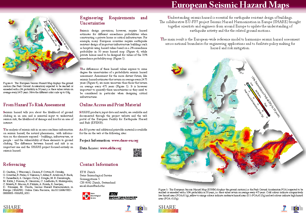
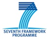
WP3: Earthquake sources and activity rates
Workpackage 3 coordinated by G. Valensise (INGV). The WP has the following objectives:
- Supply harmoized earthquake input data at European level for the SHARE project, and specifically a new homogeneous earthquake catalog.
- Construct a European model of seismic source zones (SSZ) for input to the seismic hazard computations.
- Integrate the knowledge gained in specific programs and national efforts in a wider, coordinated European context.
- Use geological and geodetic evidence in a homgeneous framework to provide additional constraints for constructing seismic source zones and for assessing earthquake activity rates.
- Build a European-wide consensus and ownership of the input data and modeling approaches, through the direct participation of national and thematic experts in the elicitation of the required knowledge and the construction of the model.
The Workpackage is structured into six tasks:
- Task 3.1: European earthquake database
- Task 3.2: European database of active faults and seismogenic sources
- Task 3.3: European crustal strain rates
- Task 3.4: Seismic Source Zones
- Task 3.5: Homogeneous determination of maximum magnitude
- Task 3.6: Earthquake activity rates
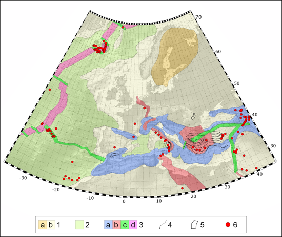
Seismotectonic map of the Euro-Mediterranean area developed for the SHARE project by WP3.2 - 1: Stable Continental Crust divided in a) shield and b) continental crust 2: Oceanic crust; 3: Active Shallow Crust, compression-dominated areas a) including thrust or reverse faulting, associated transcurrent faulting (e.g. tear faults), and contractional structures in the upper plate of subduction zones (e.g. accretionary wedges), extension-dominated areas b) including associated transcurrent faulting, major strike-slip faults and transforms c), and mid oceanic ridges d); 4: Subduction zones shown by contours at 50 km depth interval of the dipping slab; 5: Areas of deep-focus non-subduction earthquakes; 6: active volcanoes and other thermal/magmatic features